A Battle, a Prophecy, and a Place Below Sea Level
Fourteen centuries ago, the opening verses of Surah Ar-Rum described a specific location using a phrase that has puzzled and fascinated readers ever since: “adna al-ard.” The Arabic word “adna” carries a dual meaning, translating as either “nearest” or “lowest,” depending on context. Consequently, this small linguistic detail has fueled centuries of discussion, particularly since modern geology later confirmed that the very region historically associated with this verse contains the lowest exposed land surface on the entire planet.
This article examines that Quranic passage alongside the historical battle it describes and the geological data now available about Earth’s lowest points. Additionally, it explores how classical scholars interpreted “adna al-ard” long before satellite elevation measurements existed, and how contemporary geography compares that region against other low-lying areas worldwide. Throughout, three data tables translate this evidence into information general readers can follow easily. As a result, readers gain a rounded view connecting seventh-century prophecy, historical warfare, and current elevation science.
The Quranic Verses and Their Historical Context
Surah Ar-Rum opens by describing how the Romans, referring to the Byzantine Empire, had been defeated “fi adna al-ard,” and predicting that within a few years they would be victorious again. Classical exegetes such as Ibn Kathir and Al-Tabari explained that this verse referenced a real historical event: the Byzantine Empire’s defeat by the Sassanid Persian Empire during their prolonged seventh-century war. Moreover, historical accounts place this particular battle near the Dead Sea region, in the area now spanning modern Jordan, Israel, and Palestine.
Interestingly, classical commentators primarily read “adna al-ard” as “the nearest land,” referring to territory closest to the Arabian Peninsula from which the Quran was being revealed. Nevertheless, since the term’s root also relates to lowness, later scholars and writers began highlighting a second, geographically literal meaning once elevation surveys confirmed the Dead Sea basin as Earth’s lowest land point. Therefore, many contemporary commentators now present both meanings together, treating them as complementary rather than mutually exclusive readings of the same word.
In addition, the verse’s prediction proved historically accurate: the Byzantines did indeed reverse their fortunes within roughly nine years, recapturing lost territory from the Persians. This fulfilled timeline, combined with the location’s later-confirmed elevation status, has made this passage a frequently cited example within discussions connecting Quranic language to historical and geographical fact.
What Geology Confirms About Earth’s Lowest Points
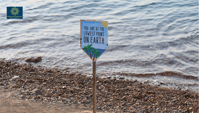
Modern surveying and satellite measurement have identified the Dead Sea basin as the lowest point of exposed land anywhere on Earth. Current measurements place its shoreline at roughly 430 meters below sea level, though this figure continues to shift due to the lake’s ongoing recession. The table below compares the Dead Sea against other notably low-elevation regions around the world.
| Location | Approximate Elevation | Region |
|---|---|---|
| Dead Sea shoreline | ~430 m below sea level | Jordan, Israel, Palestine |
| Danakil Depression | ~125 m below sea level | Ethiopia |
| Qattara Depression | ~133 m below sea level | Egypt |
| Turpan Depression | ~155 m below sea level | China |
| Death Valley (Badwater Basin) | ~86 m below sea level | United States |
| Caspian Depression | ~132 m below sea level (largest area) | Kazakhstan, Russia |
Clearly, the Dead Sea’s elevation stands well beyond any other naturally occurring low point on Earth’s land surface, making its distinction unambiguous rather than a close comparison. Furthermore, this measurement continues to become more extreme each year, since reduced inflow from the Jordan River causes the water level to drop by approximately one meter annually. As a result, the Dead Sea’s shoreline sets a new record for Earth’s lowest exposed land point almost every single year.
The Geology Behind the Dead Sea’s Depth
This extraordinary depression did not form by accident; it results from a specific and well-documented tectonic process. The Dead Sea sits along the Dead Sea Transform, a fault system marking the boundary between the Arabian and African tectonic plates. The table below outlines the key geological facts explaining why this particular basin reaches such an extreme depth.
| Geological Factor | Detail | Significance |
|---|---|---|
| Fault type | Dead Sea Transform (strike-slip and pull-apart basin) | Created a deepening trough over time |
| Formation timeline | Basin actively forming for roughly 3 million years | Long-term geological process, not sudden event |
| Fault activity duration | Active for approximately 15-20 million years | Explains basin’s unusual depth relative to surroundings |
| Lake floor depth | Up to 304 m below the water surface | Deepest hypersaline lake bed on Earth |
| Combined lowest point | Approximately 730 m below sea level (lake bed) | Deepest depression point overall |
Notably, this pull-apart basin formed as the two tectonic plates slid past one another, gradually stretching and lowering the land between them. Meanwhile, sediment accumulated within this trough over millions of years, further shaping the dramatic landscape visible today. Consequently, the Dead Sea region represents one of the most geologically active and well-studied depressions on the planet, offering scientists ongoing insight into tectonic plate boundary behavior.
Between Linguistic Debate and Scholarly Caution
Given the dual meaning of “adna,” scholars have long debated which translation best fits the verse’s original context. Some contemporary writers emphasize the “lowest land” reading, presenting it as an example of geographical precision embedded within scripture centuries before elevation surveying existed. However, other scholars caution that classical commentators overwhelmingly favored the “nearest land” interpretation, based on the surrounding historical narrative about Byzantine and Persian territorial conflict.
Nevertheless, both readings need not compete, since the historical battle location genuinely sits within the Dead Sea’s broader depression, satisfying either interpretation simultaneously. Therefore, most careful contemporary analysis treats this overlap as a meaningful point of reflection rather than a definitive scientific proof text. This measured approach mirrors how Islamic scholarship has generally approached other scripture-science discussions, valuing genuine resonance while avoiding overstated certainty about linguistic intent from fourteen centuries ago.
Tracing the Historical Timeline
To clarify how the Quranic prediction aligned with actual historical events, the table below summarizes the key dates associated with the Byzantine-Persian conflict referenced in Surah Ar-Rum.
| Event | Approximate Date | Historical Detail |
|---|---|---|
| Byzantine defeat near the Dead Sea region | 613-614 CE | Persian forces gain significant territory |
| Surah Ar-Rum revealed, predicting Byzantine recovery | Shortly after 614 CE | Verse foretells victory “within a few years” |
| Byzantine military recovery begins | 622 CE | Emperor Heraclius launches counteroffensives |
| Decisive Byzantine victory over Persia | 627-628 CE | Fulfills the timeframe described in the verse |
Clearly, this timeline places the Byzantine recovery within the nine-year window traditionally associated with the Arabic phrase “bid’i sinin,” commonly translated as “a few years.” Meanwhile, historians generally regard this sequence of events as well documented, lending additional context to how the verse’s audience would have understood its prediction as it unfolded in real time.
Conclusion: Geography, History, and Scripture Aligning
The Dead Sea basin’s distinction as Earth’s lowest exposed land point offers a compelling backdrop to one of the Quran’s more geographically specific passages. Whether read as “nearest land” or “lowest land,” the verse’s connection to this particular region remains historically and geologically grounded. Additionally, the fulfilled prophecy regarding Byzantine recovery adds a documented historical dimension to the passage’s broader significance.
Ultimately, this convergence between ancient text, historical record, and modern elevation science illustrates how careful reading of scripture alongside available geographical evidence can deepen understanding, without requiring readers to abandon appropriate scholarly caution about certainty.